
The likely site of a lost city believed to be the final refuge of the Lacandon Ch’ol Maya community may have been identified in the jungle of southeastern Mexico. Archaeologists from Mexico’s National Institute of Anthropology and History (INAH), including Josuhé Lozada Toledo from the institute’s centre in Chiapas, worked with Brent Woodfill of Winthrop University in the US and Yuko Shiratori of Rissho University in Japan to identify what they believe are the the remnants of Sac Balam. Their findings were first reported last month.
Revealed through advanced Lidar scanning, the Sac Balam site features monumental architecture, ceremonial plazas, and partially preserved stelae inscribed with glyphic texts dating from the late 17th century. The site’s dating defies long-held assumptions that the Maya world had fully collapsed or been absorbed into Spanish colonial structures by that time.
After the fall of their capital, Lacam-Tún, in 1586, the Lacandon Ch’ol Maya retreated deeper into the Lacandon Jungle and established Sac Balam as a new stronghold. The settlement maintained its independence for around 110 years before being encountered by a Spanish friar named Pedro de la Concepción in 1695. The Spanish eventually took it over, renamed it Nuestra Señora de Dolores and it was ultimately abandoned around 1721.
“It was the most grueling field experience of my career,” Toledo said in a statement. “Sac Balam appears to have been a politically and spiritually significant settlement, perhaps a capital in exile.”
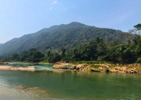
Toledo, who led the search for the site, employed a geographic information system (GIS) to reconstruct possible historical routes to and from the site, based on contemporaneous records, as well as and geographic markers. The predicted location matched a site in the Montes Azules Biosphere Reserve, near the Jataté and Ixcán rivers. He added: “In the end, we found the archaeological evidence right at the spot I had marked.”
According to Lozada, the scale of the site’s architecture suggests that Sac Balam had been carefully constructed to house retreating Lacandon Ch’ol Maya groups, offering protection and a place to continue their communal life beyond colonial reach. The Maya civilization flourished across present-day southern Mexico, Guatemala, Belize, and parts of Honduras for over 2,000 years. Though many of its largest cities declined after the Maya Classic Period (250-900), the Ancient Maya civilization did not vanish. Instead, communities adapted by living in smaller settlements and, when the Spanish conquest of the region began, by resisting colonialism by whatever means they could.
Among the most resilient of these communities were the Lacandon Ch’ol Maya, who occupied the rainforest regions in present-day southeastern Mexico and parts of western Guatemala. When Hernán Cortés arrived in the area in the early 16th century, the Spanish violently brought down the Aztec Empire. But in the Maya lowlands during the 16th and 17th centuries, Spanish expeditions failed to penetrate Lacandon territory, thwarted by the region’s thick jungle, lack of navigable roads, and resistance by the Lacandon Ch’ol Maya.
The city’s Maya name, which translates to “Land of the White Jaguar”, reflects its importance. In Maya belief, the jaguar is linked to protection and strength. The jaguar’s ability to move undetected through the jungle may have also echoed the community’s survival strategy.
The prospect of the discovery of Sac Balam complicates the conventional narrative of colonialism in Mexico, which typically frames the fall of the Aztec empire in 1521 as the beginning of Spanish rule. The Maya lands during the colonial era included the Lacadon jungle, over which the Spanish failed to establish control throughout the entire 17th century. Spanish maps of the era even labeled the Lacandon region as “Tierra de Guerra” (land of war).


